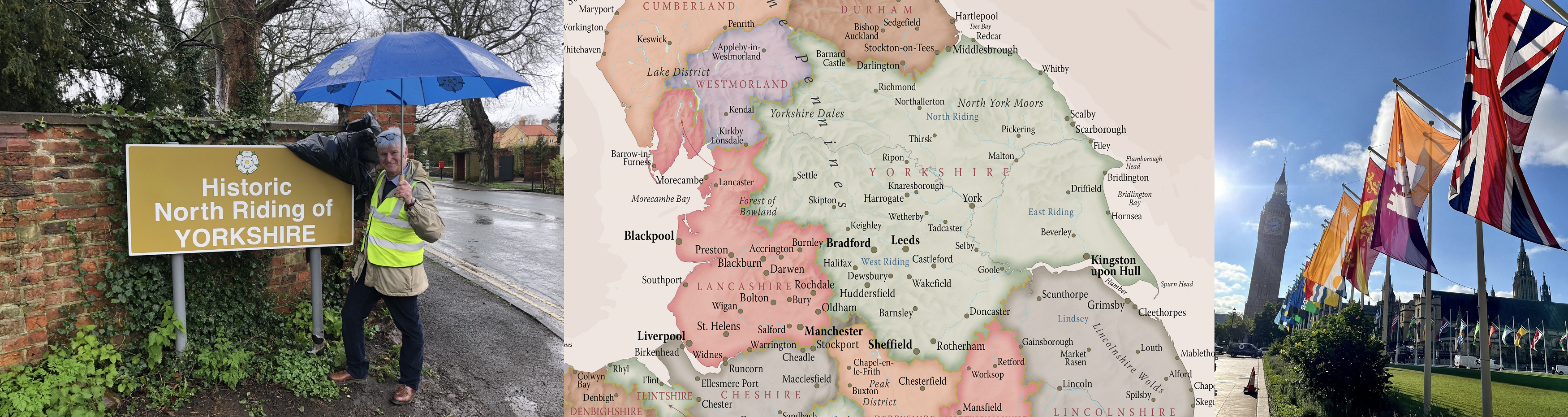
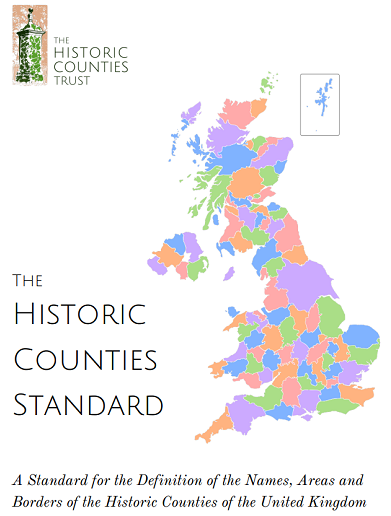
The Historic Counties Standard
The Historic Counties Standard provides a comprehensive definition of the names, areas and borders of the historic counties of the United Kingdom.
The Historic Counties Standard can be downloaded as a PDF document.
By providing a definition for the terminology and the names, areas and borders of the historic counties, the Standard enables a more consistent use of the historic counties to be made in those numerous contexts for which they are the most natural geographical framework, principally in the fields of history, geography, heritage and education. For example:
- In the organisation, indexing and cataloguing of historical documents and artefacts;
- In descriptions of the location of historical events;
- In local history studies (e.g. place name surveys, county histories etc.);
- In historical geography (e.g. studies of changes in demography, land-use etc.);
- In the presentation to the public (e.g. in museums, libraries, record offices etc.) of material relating to history;
- In family history publications and data sources;
- In educational maps and publications;
- In the classification and cataloguing of ancient and historical monuments and buildings, and in publications describing these.
The Historic Counties Standard provides the definition of historic county used across the heritage and geography sectors, including by:
- The Office for National Statistics in its Index of Place Names in Great Britain
- The Gazetteer of British Place Names
- The Wikidata open knowledge base
© Historic Counties Trust 2025 · Registered Charity No. 1114371 · enquiries@historiccountiestrust.co.uk · About Us